Please use this identifier to cite or link to this item:
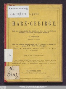
http://dx.doi.org/10.25673/60554| Title: | Karte vom Harzgebirge : nach den Originalkarten des Königl: Berg und Forstamtes zu Clausthal, nach Papen und Berghaus / entworfen von C. Prediger ; nach den neuesten Beobachtungen von F.A. Roemer, A. Streng etc. geognostisch colorirt von C. Prediger |
| Publisher / Printer: | Grosse'sche Buchhandlung Fr. Malté |
| Other: | Papen, August Berghaus, Heinrich Karl Wilhelm Roemer, Friedrich Adolph Streng, Johann August |
| Published: | Clausthal / In Stuttgart : Verlag der Grosseschen Buchhandlung ; Art. Anstalt v. Fr. Malté, 1860 |
| Scale: | 1:300 000 |
| Extent: | 1 Karte; 23 x 40 cm, auf Blatt 40 x 49 cm, gefaltet im Umschlag 14 x 11 cm Farblithografie |
| Annotations: | Nullmeridian: Ferro und Paris. - Maßstab in grafischer Form (Geographische Meilen, Preussische Meilen) Titel- und Maßstabskartusche oben rechts. - Erklärungskartuschen rechts und links vom Profil Mit 1 "Profilansicht des Harzgebirges" Karte Erscheinungsjahr nach Datierung auf dem Umschlag; Erscheinungsjahr auf Karte: 1859 |
| Language: | German |
| Subjects: | Harz |
| Online Edition: | Halle (Saale) : Universitäts- und Landesbibliothek Sachsen-Anhalt, 2022 |
| Original Publication: | Universitäts- und Landesbibliothek Sachsen-Anhalt, Altkt U I [3] 1/1 |
| URN: | urn:nbn:de:gbv:3:3-1192015415-241943035-11 |
| URI: | https://opendata.uni-halle.de//handle/1981185920/62505 http://dx.doi.org/10.25673/60554 |
| Open Access: |  Open access publication Open access publication |
| License: |  Creative Commons Attribution 4.0") (CC BY 4.0) Creative Commons Attribution 4.0 (CC BY 4.0) Creative Commons Attribution 4.0 |
| Sponsor/Funder: | Die Digitalisierung wurde durch die Deutsche Digitale Bibliothek im Rahmen des von der Beauftragten der Bundesregierung für Kultur und Medien (BKM) geförderten Programms NEUSTART KULTUR ermöglicht. |
| Appears in Collections: | Karten und Atlanten |
Ressources:
 |
|