Please use this identifier to cite or link to this item:
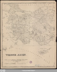
http://dx.doi.org/10.25673/64257| Title: | Vorder-Asien : Reduction nach der Karte von Kleinasien von v. Vincke, Fischer, v. Moltke und Kiepert, und der Aufnahme des Euphrat und Tigris von Chesney / mit Benutzung aller übrigen neuesten Hülfsmittel, namentlich der Itinerare von Hamilton, Ainsworth, Brant, u.a. gezeichnet von H. Kiepert, April und Mai 1843 |
| Other: | Vincke, Karl, von Fischer, Theobald Moltke, Helmuth Karl Bernhard, von Chesney, Francis Rawdon Hamilton, William John Ainsworth, William Francis Brant, James |
| Published: | [Erscheinungsort nicht ermittelbar] : [Verlag nicht ermittelbar], [1843] |
| Scale: | 1:1 500 000 |
| Coordinates: | E 24°50'00"-E 45°53'00"/N 42°20'00"-N 33°15'00" |
| Extent: | 1 Karte auf 2 Blättern; 70 x 116 cm, Blätter 76 x 63 cm und 75 x 62 cm Lithografie |
| Annotations: | Nullmeridian: Paris und Greenwich. - Maßstab in grafischer Form (Deutsche geographische Meilen, Englische und Französische geograph. Meilen, Olympische Stadien ...) Altkarte Erscheinungsjahr nach Datum der Kartenzeichnung bestimmt |
| Language: | German |
| Online Edition: | Halle (Saale) : Universitäts- und Landesbibliothek Sachsen-Anhalt, 2022 |
| Original Publication: | Universitäts- und Landesbibliothek Sachsen-Anhalt, Altkt B II 7 [3] 2 |
| URN: | urn:nbn:de:gbv:3:3-1192015415-1713940620-17 |
| URI: | https://opendata.uni-halle.de//handle/1981185920/66208 http://dx.doi.org/10.25673/64257 |
| Open Access: |  Open access publication Open access publication |
| License: |  Creative Commons Attribution 4.0") (CC BY 4.0) Creative Commons Attribution 4.0 (CC BY 4.0) Creative Commons Attribution 4.0 |
| Sponsor/Funder: | Die Digitalisierung wurde durch die Deutsche Digitale Bibliothek im Rahmen des von der Beauftragten der Bundesregierung für Kultur und Medien (BKM) geförderten Programms NEUSTART KULTUR ermöglicht. |
| Appears in Collections: | Karten und Atlanten |
Ressources:
 |
|